


Old style regional parks sign at Ridge Road Track, a bit hobbitish, but has stood the test of time
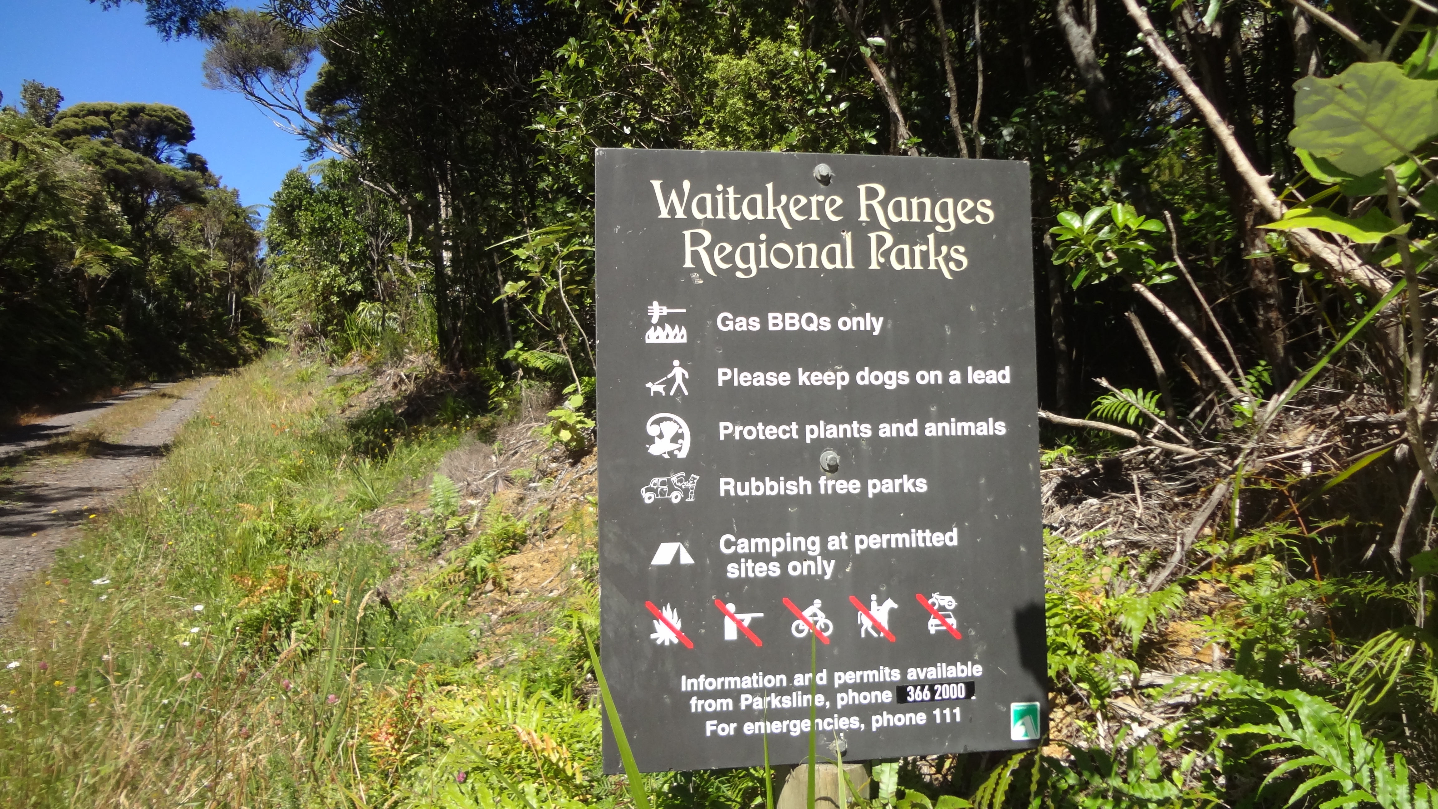
After exhausting all the tracks west of Anawhata Road, it was time to start exploring the tracks east of the road which go into the interior of the Waitakere Ranges, the water catchment area bounded by Piha Road, Scenic Drive and Te Henga Road.
The Ridge Road Track heads inland off the right of Anawhata Road, not far past Cutty Grass Track. I should have realised that the name told us it was a road of sorts rather than a track. Made of red Waitakere clay, that geologist Bruce Hayward tells us is volcanic in origin, it’s wide enough at the start for a small four wheel drive or quad and roughly gravelled. That eventually peters out but the track remains wider than most and blessedly, no steps!
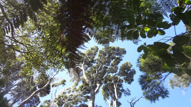
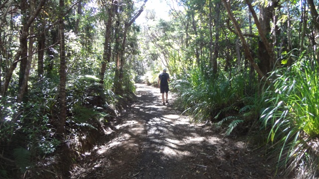 The track undulates along the ridge with not much to be seen further afield as there are no view shafts. The vegetation is relatively young, dominated by rimu, kanaka, ponga and many, many ferns of several varieties. Only the odd kauri, the area was milled and farmed in the past, and gives an idea of what the bush would look like if kauri dieback wiped out kauri. In time it will become mature rimu forest.
Lots of evidence of pest work with grid markers of Ark in the Park mainland sanctuary attached to trees on the east side of the track. Some kokaho have shifted beyond the main predator control area to nest here, and the pest control has followed them.
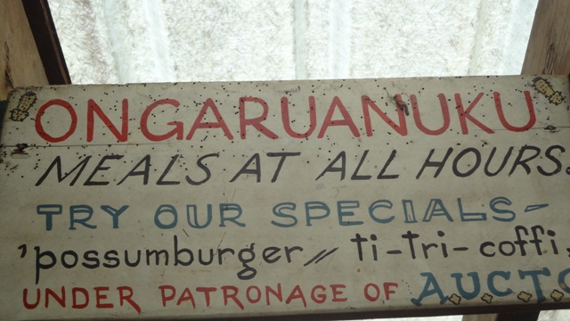
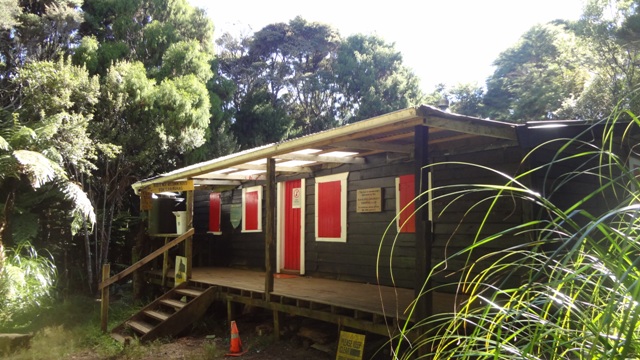 After about an hour, you come across the University Tramping Club hut or Ongaruanuku. The name is made up and means “place of the learned”.
It’s easy to walk right past the entrance to the hut, which isn’t signposted, so keep your eyes peeled to the left.
The hut door is open – we guessed it would not be in the nature of those bent on vandalism to walk this far! You can book the hut for $5 a night through Auckland Council. It’s well set up with cooking gear, a piano, dart board, and Maori-style sleeping platforms. There are 3 loos, and every wall is decorated with signs purloined from here there and everywhere. The hut started life as a bushman’s hut but was adopted by the tramping club in the 1940s.
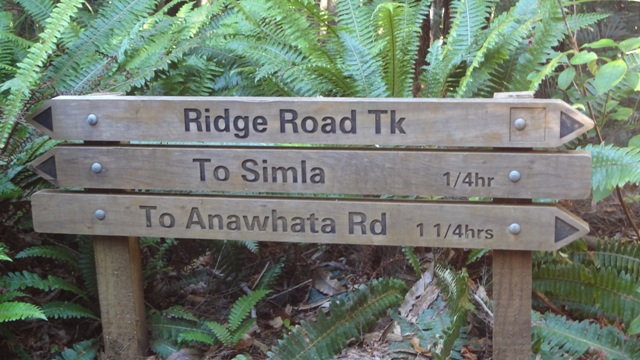 We ate lunch here, and then walked on to Simla. You walk past rows of the most enormous ancient pines that the indigenous forest is taking over. They are draped with rata and epiphytes. These were once the boundary line or windbreak of Simla farm. I’m trying to find out more about Simla – disappointingly, the interpretation at Simla junction – a flat clearing in the bush – didn’t tell us much. It’s part of the Montana Heritage Trail.
From here, if you wanted to, you could continue on other tracks, that would take you to Waitakere Dam or Cascades or Te Henga. These will have to wait for another day.
We retraced our footsteps back to Anawhata Road. The whole journey too us 3 hours return.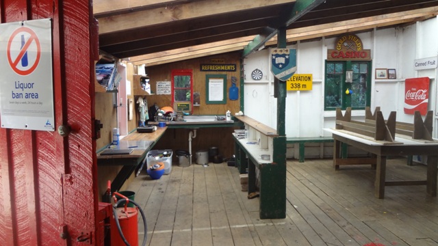
 I
I